
We didn’t write any posts for two days. During these two days, many things have happened. Firstly, we didn’t have a good connection to civilization or the technical ability to post anything. Secondly, we needed time to process all the events from the last two days. It was intense, and putting it all into words will require some time, which I am willing to take. So, let’s start from the beginning.
Wallace, Idaho is quite different from Sandpoint where we stayed the previous night. Sandpoint is a crowded tourist spot with bars, hotels, beaches, and lots of entertainment, while Wallace is a small, old, slow-paced town nested among mountains, bordered on one side by a small river and crossed in another direction by a small creek. Wallace is located in the Silver Valley mining district in Shoshone County. It was once famous as the “Silver Capital of the World,” with a long tradition of silver mining. Wallace is also known for a few more things. The movie “Dante’s Peak” was filmed in Wallace, and the town is considered the “Center of the Universe.” In 2004, the Mayor of Wallace proclaimed the town as the center of the universe, reasoning that it couldn’t be proven otherwise. Today, a manhole cover in the city marks the exact spot, and the citizens of Wallace celebrate this yearly.
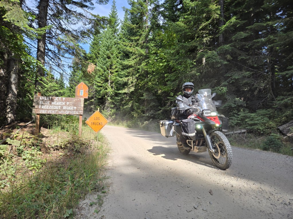
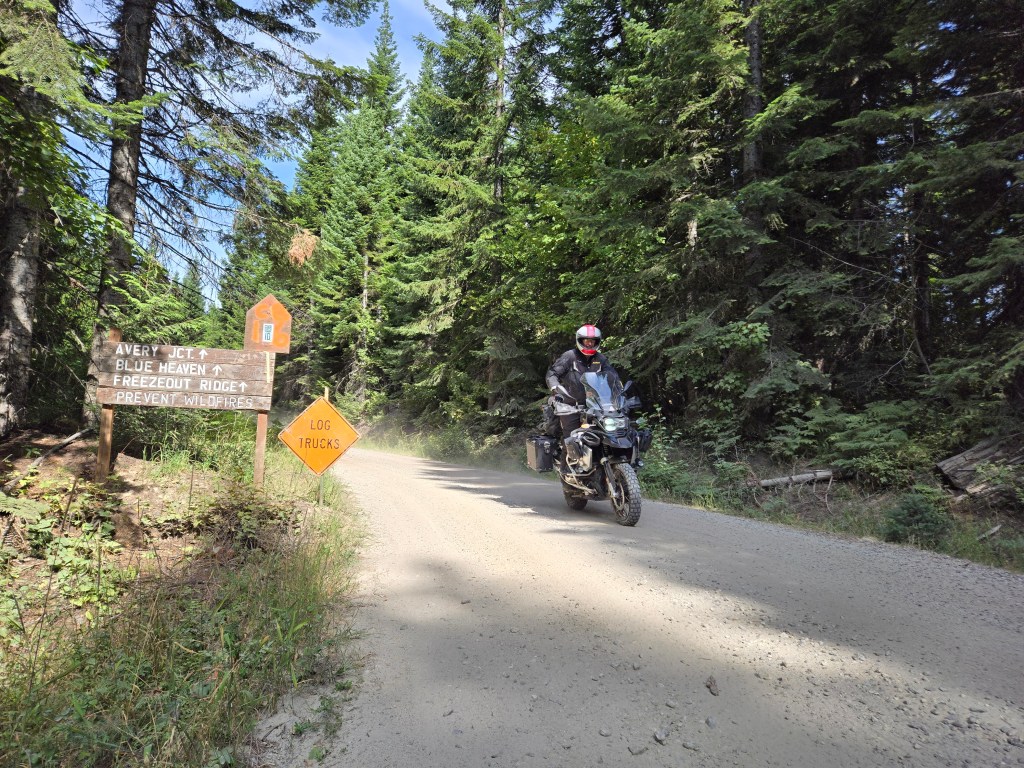
Monday morning in “the center of the universe” was very cold as we walked to the Brooks Hotel for a quick breakfast. We needed a good, hearty meal, as the next place where we could eat would be our destination, Pierce, Idaho. Our route today doesn’t pass through many places where we could find establishments that exchange food for money. The only small town we would pass through is Avery, which is so tiny it doesn’t have any major intersections, just a few houses along the main road. A strong breakfast would give us the energy for a long day on the road, and the Brooks Hotel delivered. Luckily, by the time we finished our meal, the temperature had risen a bit.
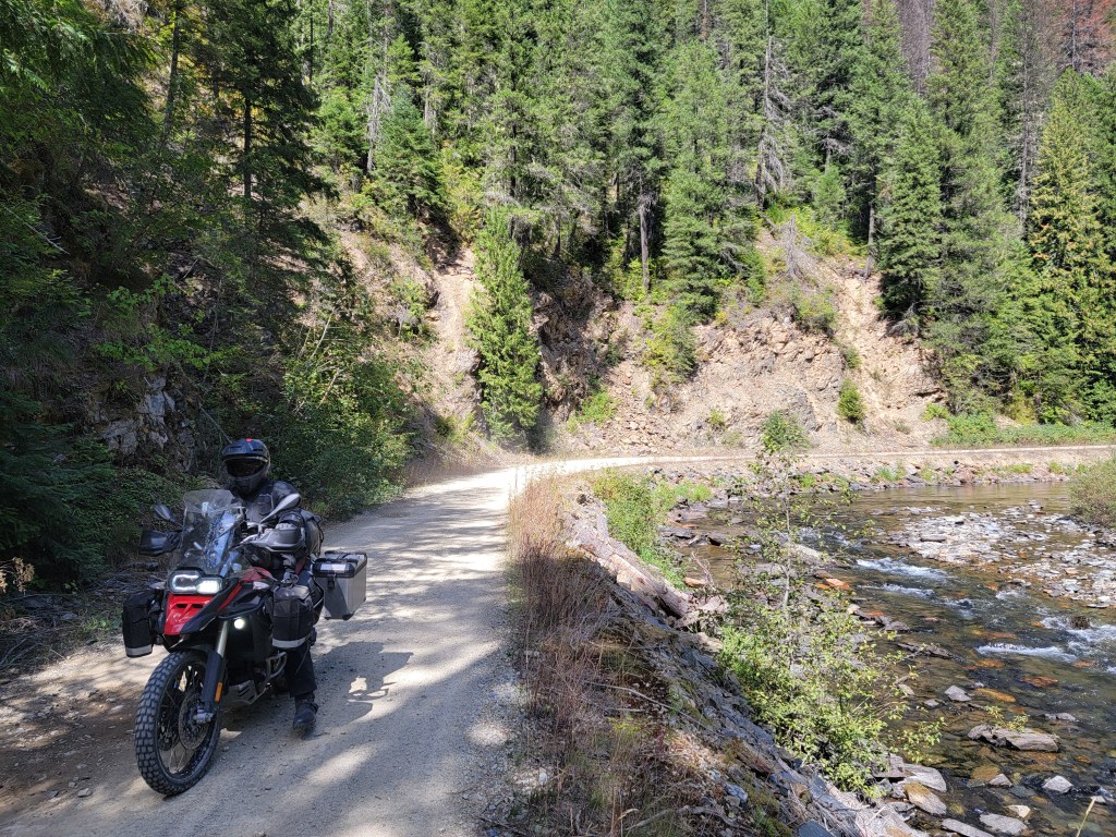
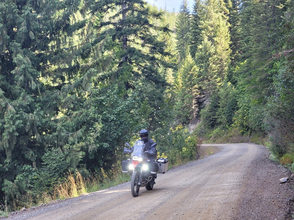
As soon as we left Wallace, we hit a gravel road — a very well-maintained, nice, and smooth logging road. Compared to the roads from the day before, it felt like a six-lane highway. The only danger was the frequent log truck traffic, which kicked up so much dust that visibility was reduced to just a few meters. It took some time for the dust to settle. We had three encounters with log trucks. The first two were good; the drivers slowed down significantly as they passed by, showing us some respect by not raising much dust. The third driver, however, zipped by us at full speed, raising so much dust that I won’t be able to wash it from my riding gear for a long time.

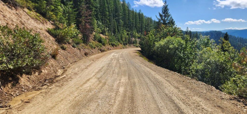
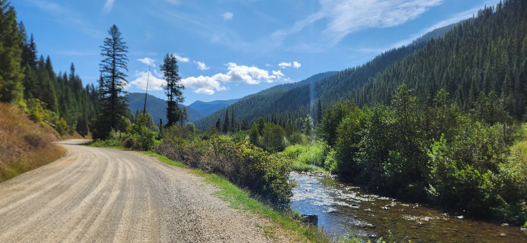

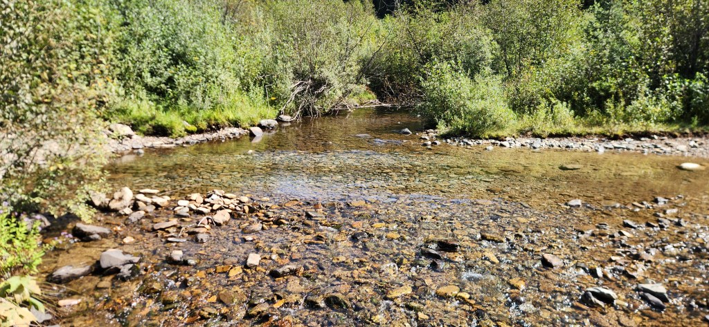
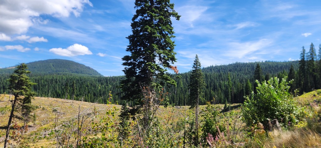
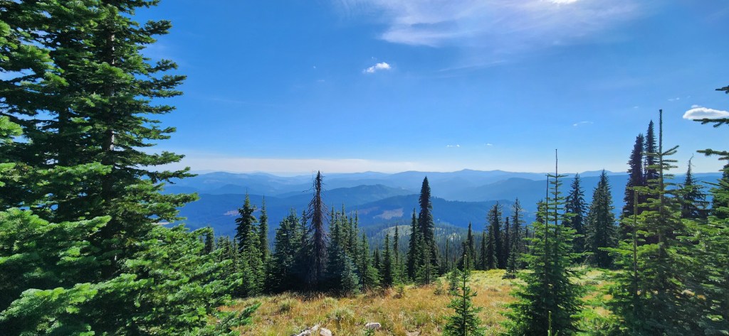
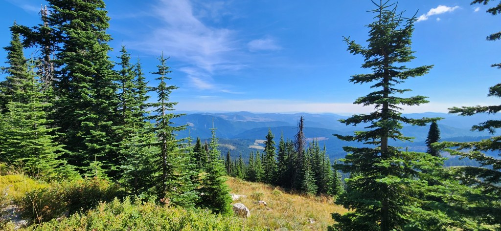
This part of the road follows the curvature of the river with small changes in elevation. The river, like all the rivers and creeks in Idaho, is crystal clear. They are numerous, they are everywhere, and they are beautiful.

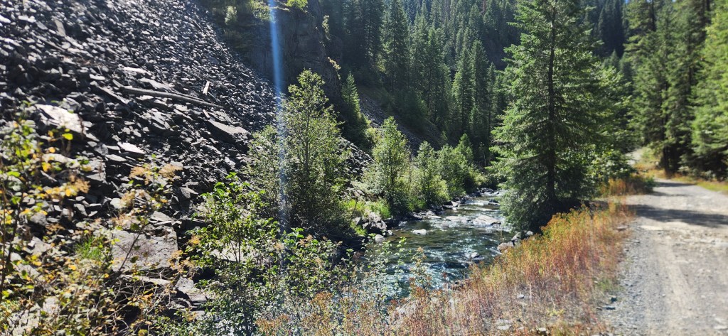
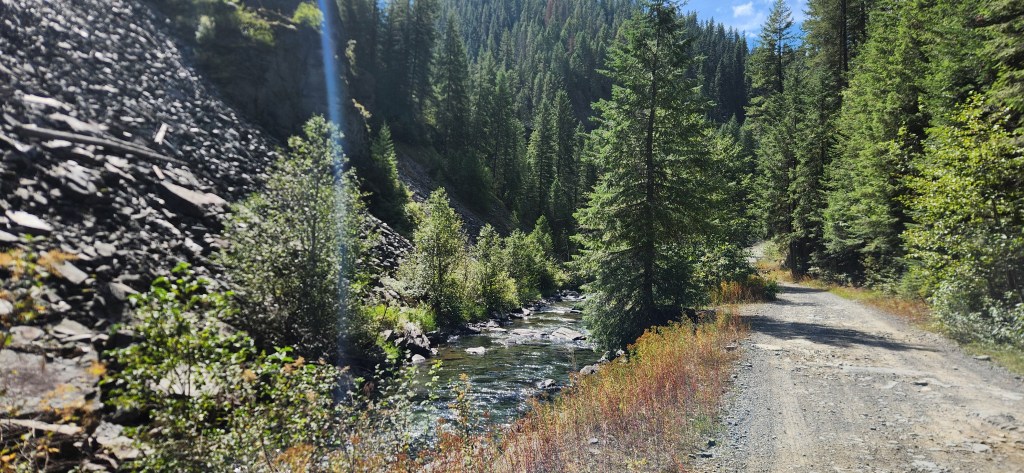


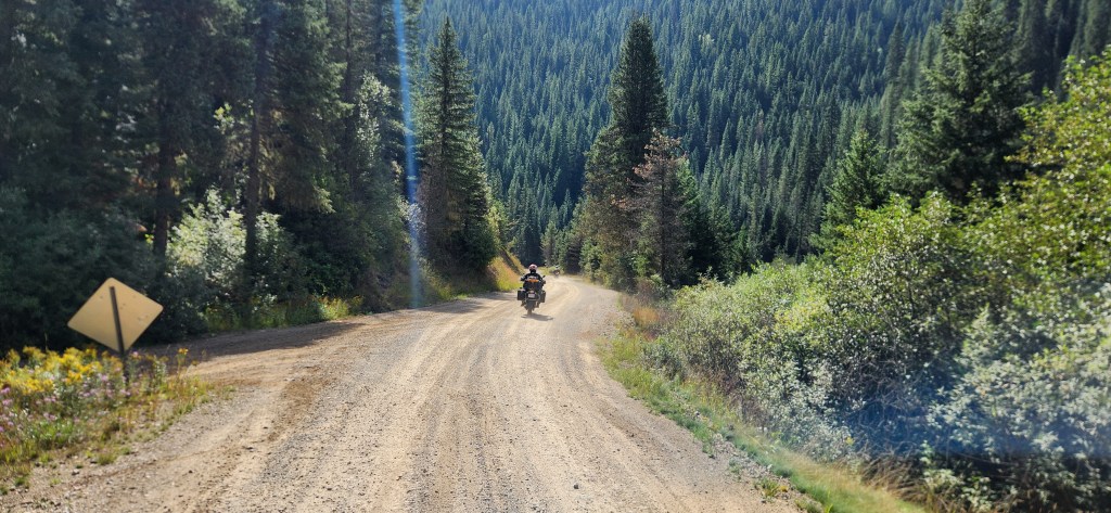
We reached intersection where we should depart from that nice logging road. The new road was narrower and not as smooth as the previous one. It followed the St. Joe River all the way to Avery. At one point, the road forked into two roads and they merge again several miles later. One stays high above the river and goes through several tunnels, while the other, more scenic route, crosses the river with a small one-lane bridge and runs along the river for most of the way. We chose the scenic option over the tunnels and crossed the bridge. No more than a hundred meters from the bridge, we saw a ramp over the road. It was closed for larger vehicles, but there was enough space between the ramp and the river for a motorcycle to pass through.

Without hesitation, we entered the road and quickly realized why it was restricted. It was a coarse and very narrow road, running right next to the river. A small mistake with a large vehicle could send it into the river. In some places, the road climbed twenty or thirty meters above the river with abrupt edge on the river side, where any mistake could be fatal. But the risk had its reward: the scenery was worth it.


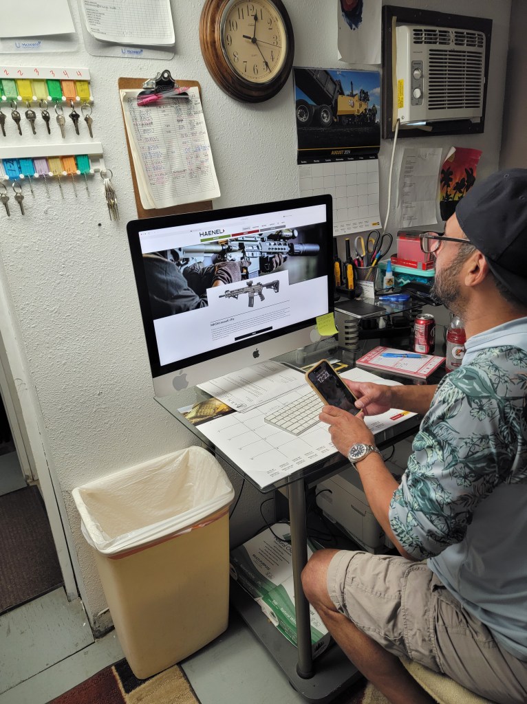
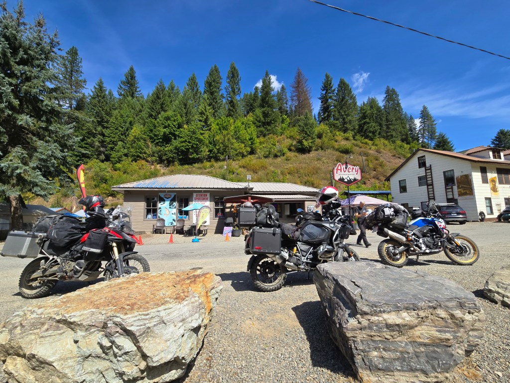
The roads merged just a mile or two before Avery, which was our stop for a coffee break. As mentioned earlier, this is a very small place with one general store, a beer bar, and a few houses next to it. Coffee is sold in the general store. It wasn’t the best coffee we’d ever had, but it wasn’t the worst either, and we needed it just as much as we needed a break. The people in the store were very friendly. We had a small talk moment, and in Idaho, small talk isn’t about the weather — it’s about guns. The guy in the back room, probably the owner, was looking at a web page featuring some high-end hunting rifles. As soon as I asked if he was buying one, he launched into a five-minute monologue about how good those guns were, the features they had, and so on. I pretended to be an expert, nodding my head and agreeing with his monologue. In the end, Zoran and I learned that those guns cost more than my motorcycle did back when I bought it.
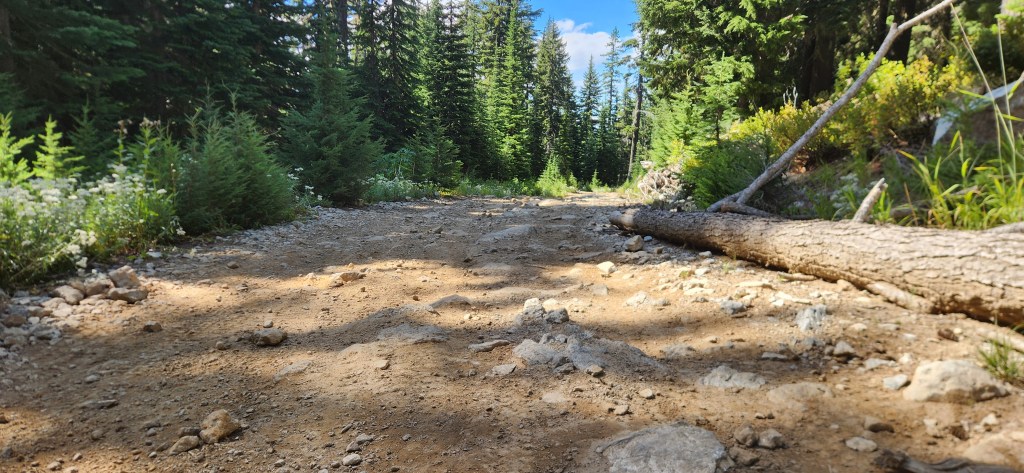
After Avery, we followed a paved road for two miles and then turned onto Road 301. At the beginning, the road was in good shape, but then it started climbing steeply up the mountain. The hill climbs were rutted, with wide, deep ruts going in all directions. It was important to create a line in your head to avoid all the ruts and other obstacles, stick to it, open the throttle, and ride with confidence. The good thing about climbing is that it’s relatively easy to control your speed. Going downhill is quite different, especially if you’re riding over large, loose stones. We would experience that soon.
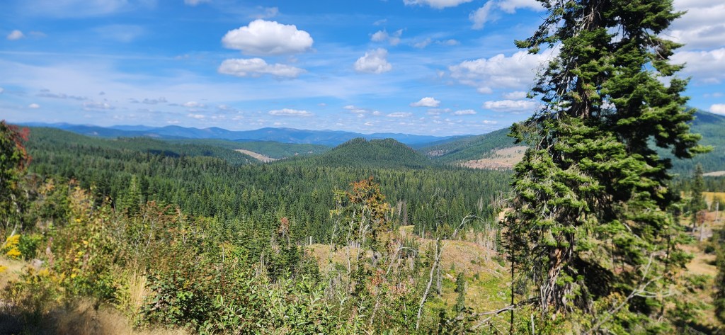
As we climbed, the road became harder to ride. The ruts grew deeper and larger, loose rocks were scattered all over. In some places, water from melting snow had washed out the top layer of the road, fully exposing the large stones used as its foundation. Hitting them hard could damage the motorcycle or launch you into the air, though this is somewhat predictable and manageable. Loose rocks, however, are dangerous; they can throw you completely off balance and knock you down hard. But despite the challenges, the scenery was wonderful, and the weather was perfect.


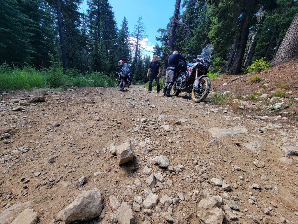
We stayed on Road 301 for quite a while. By the time we reached the intersection with our next road, Road 301 had become very difficult to ride on. Then, we turned onto Road 457. If this were a documentary on a TV, now would be the perfect moment for a commercial break. Road 457 was something different — a totally new chapter in our understanding of just how bad road conditions could be.
As soon as we turned onto Road 457, it began to climb very steeply. The road was so badly washed out that the ruts looked like small Grand Canyons, or narrow, deep glacier crevasses. The ruts running along the road were extremely dangerous; if one of your wheels fell into one, there would be no way to recover. On a positive note, the top layer of hard-packed gravel was still present for most of the first hill climb. It was obvious from the start that this road was no joke and required the highest level of riding skills and techniques.

After the first hill climb, we reached a relatively flat section with lots of loose stones of various sizes. Most of the rocks that had been washed down by water ended up there. Then came another hill climb, and another, and another—each more challenging than the previous. All three of us have been riding motorcycles for many years, but none of us had ever ridden roads like this before. The top surface was completely gone, totally washed out. Large stones were still embedded in the road base with a significant portion exposed, and there were lots—and I really mean lots—of loose stones everywhere. Each one was completely unpredictable and could easily throw you off balance.
It was time to bring out our A-game—the highest level of riding skills we had. To my surprise, I discovered skills I didn’t even know I possessed. All those years of riding crazy, challenging roads all around North America and all the skills I had gathered over time seemed to come together at that very moment. I didn’t feel any discomfort in this totally new situation. I felt very calm and extremely focused. The margin for error was so narrow, and I was determined not to make a mistake. Now that I think about it, I haven’t been this present in the moment so many times in my life. It was deep, laser-focused concentration—almost like a form of hypnosis.
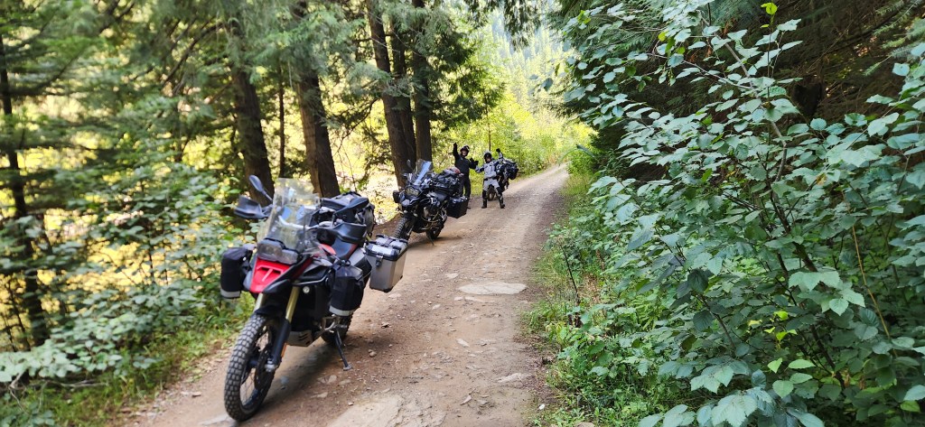
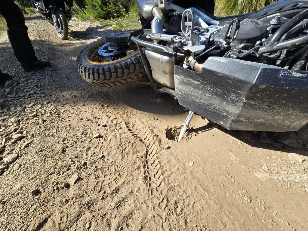
Julian was first, Zoran was riding second, and I was at the tail. We had to keep some distance between us so we could see the road better. We were still climbing Goat Mountain. We were at almost 6,400 feet, near the top of the mountain, when I saw Zoran’s motorcycle parked on the side and Julian’s bike lying on the ground. Julian had dropped his bike. Fortunately, Julian was OK. He had just wanted to stop in front of a very rocky climb to take a little rest before continuing. Unfortunately, overwhelmed by the new experience, he didn’t notice that he had stopped on an uneven surface, and when the bike started to lean to the lower side, he couldn’t hold it. He had to let the bike go down to save himself from potential injury. The same thing happened to me a few years ago—nothing serious. This kind of thing happens quite often on adventures like this. Both Julian and his bike were fine, with just a small scratch on the bike.


The bike had landed at a strange angle, which didn’t give us good access to lift it up. Besides that, Julian was riding without panniers. In situations like this, panniers are helpful because they prevent the bike from lying flat on the ground, making it easier for lifting. We were able to lift the bike after Julian detached all the luggage. About half an hour later, after repacking the luggage, we were ready to continue. Same order again: Julian, Zoran, and me, with a proper distance between us.
Not a mile later, Julian dropped his bike again. This time, it happened while he was riding—loose stones took him down. It took us a little less time to lift the bike up this time, as we were able to do it with the luggage still attached. Still, we had lost a good amount of time. Julian needed some time to recover mentally from this situation; his riding mojo was deflated. He was tired and needed a good break, which was completely understandable.

As soon as we started again, not even a mile later, we reached a spot with a gorgeous view. Julian stopped to take a photo. He opened the side stand, but as soon as he released the bike, the side stand sank into the sand, and his bike went down again. This was too much for him—three times in less than two miles. He was exhausted, both physically and mentally.
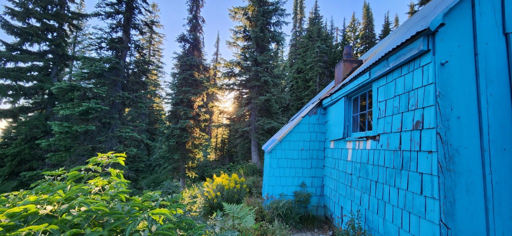
You might remember my story about the Backcountry Discovery Route (BDR) from the beginning of this blog. In the Idaho BDR promotion video, they stayed overnight at the Blue Heaven cabin. This cabin is privately owned, but the owner keeps it open for people passing by as a safe haven in case they need shelter for the night. The only conditions are to keep it clean and take your trash with you. What a generous gesture! The location of the cabin is marked on the Idaho BDR map, and we also had its location saved in our GPS.
It was hard to comprehend how lucky we were—the Blue Heaven cabin was just 4.1 miles from where we were at that point. The riders’ protective angels were working overtime for us. The decision was easy: we would head to the Blue Heaven cabin and stay there overnight. In the morning, we would be rested and ready to continue. On the way to the cabin, we had a few water puddles to negotiate, but we reached the cabin in a short time.


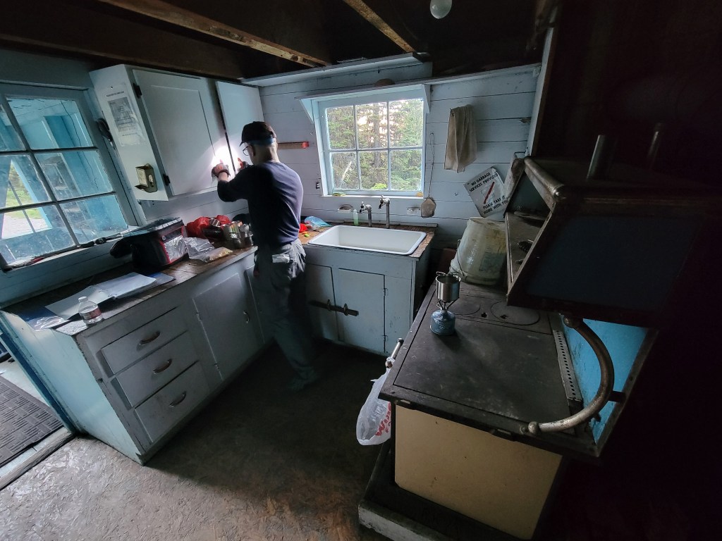
Julian tried to open the cabin, but it seemed to be locked. I tried as well, but the door still felt locked. It seemed we wouldn’t be sleeping in the cabin tonight, and we would have to set up a campsite and pitch our tents in front of the cabin. It took us less than an hour to get everything ready. As soon as we finished setting up the tents, Julian went back to the cabin and tried the door again. This time, it opened without any problems. Great! We wouldn’t be sleeping outside after all.
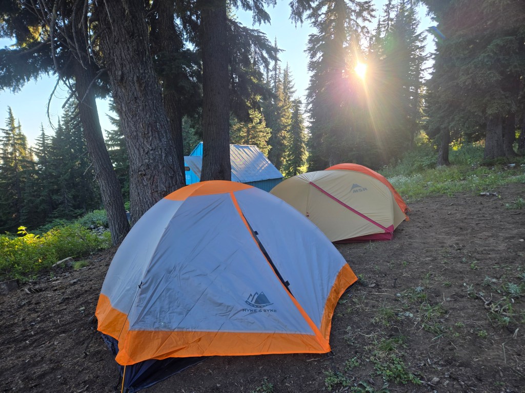
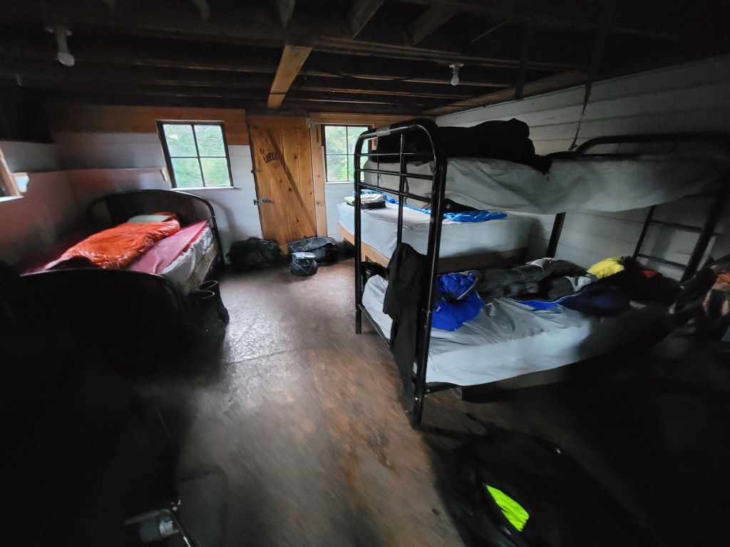
The cabin was modest. It had two queen beds and a bunk bed—more than enough for the two of us. The kitchen was simple, anr there was a running water, which was all we needed for the night. It may have been modest, but compared to sleeping in tents, the cabin felt like a four-star hotel. It took us some time to pack up the tents and cook our dinner.
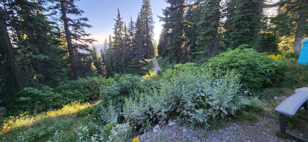
As we sat next to the bonfire, the sun was setting behind the horizon. We weren’t talking much; each of us was lost in thoughts.

I was thinking about everything that had happened during the day. I was relieved that Julian was OK. He was mentally exhausted, but physically he was in good shape. I would have felt terrible if something had happened to him—or to any of us. Being an engineer, my thinking process is always very analytical. I asked myself several questions. Do we have the riding skills to handle these roads? Yes, absolutely. Can we make it to the finish line as planned? Yes, absolutely. Can we do it within the time frame we planned? Yes, probably. But is it worth risking broken limbs or something worse for any of us? No, absolutely not. The answer to the last question outweighed all the previous ones. Today it was Julian; tomorrow it could be me or Zoran, and I would never forgive myself if something bad happened to any of us. It seemed like Zoran and Julian were following a similar thought process. I don’t know who started first, but we quickly came to the conclusion that we needed to change our plan. We had to reach the safety of better roads as soon as possible. I pulled out my map, and we started planning.
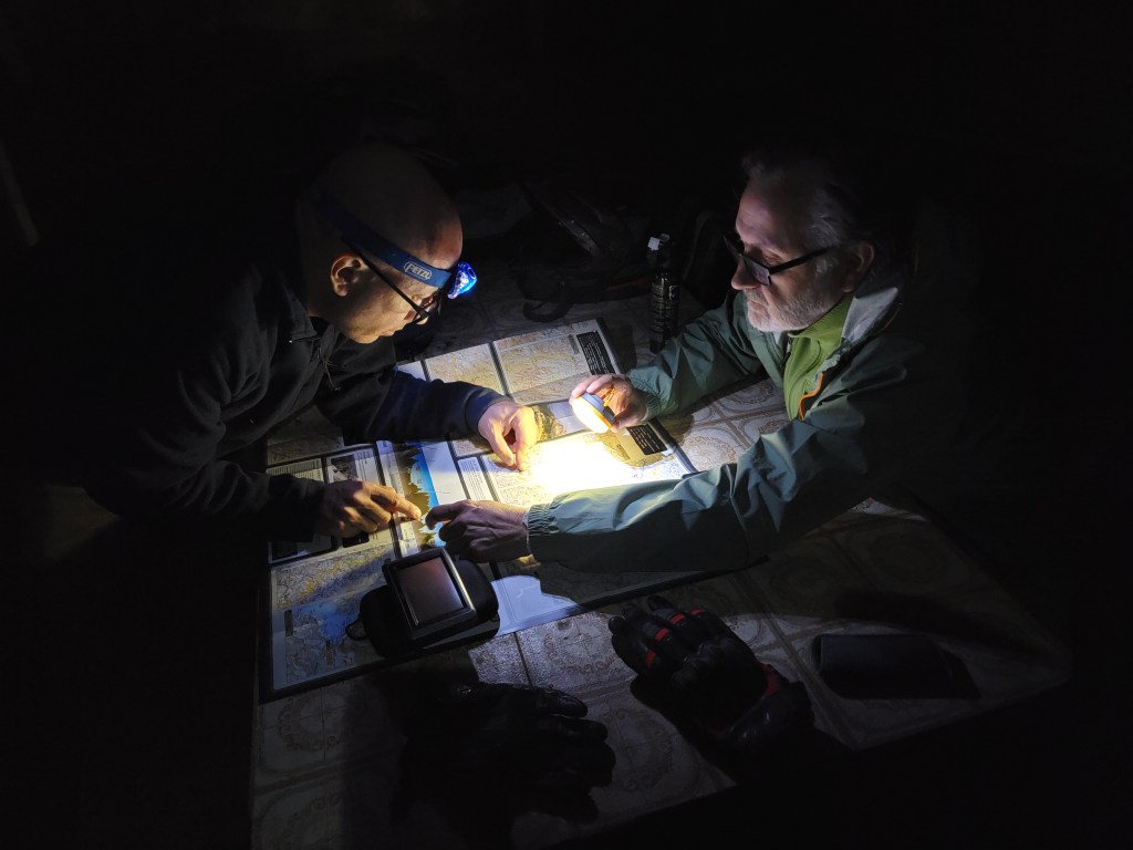
We found several options, but we had no idea how good or bad those alternate roads are. On the map, they all looked the same—red dotted lines for both good and bad back roads. We would have to figure it out as we went the next day. For now, we needed to get some rest. Back home, we have a saying: “Morning is smarter than evening.” I was hoping we would benefit from the next day.
Morning came quickly. During the moments I was awake throughout the night, I kept thinking about the tire tracks of a large truck that I had seen in the cabin’s front yard earlier. A truck like that couldn’t have negotiated the roads we had survived the day before. The road to the cabin, in the direction we were heading, had to be much easier—easy enough for a heavy truck.
During the night, we had a little encounter with the small rodents living in the cabin. We were intruding on their space, but thankfully, none of us got bitten. They seemed to show us some respect. We could just hear them running around—that’s all, or at least, that’s what we think.


While we were drinking our morning coffee, we heard a motorcycle approaching from the direction we were planning to head. We quickly ran outside to stop the rider and ask about the road conditions. We were surprised to see that he was riding alone, heading into the same challenging terrain we had just left behind. His name was Peter, a Polish guy living in Colorado. He told us that the bad road continued for no more than two miles, and after that, the roads would be much easier to ride. This was a huge relief for us.
We packed up and left the cabin. Just as Peter had said, not even two miles down the road, the conditions improved significantly. We quickly descended to the bottom of the mountain and reached a road that would take us to Clarkia, a small town in Idaho. From there, we had plenty of options to continue our trip. Zoran would take over the lead from there.
The last 24 hours were intense. Our overnight stay at the Blue Heaven cabin will stay with us forever, along with the challenges we faced throughout the day. The most important thing is that we’re all in one piece. Everything that happened in the last 24 hours is the very definition of a good ADVENTURE.
S.

well done guys.
LikeLike
Julian’s bike was smart, obviously saying ‘give me a break!’
Glad you made it in one piece !!!
LikeLike